
I bumped into a hunter in Bondi State Forest and as you do, started to compare locations. As he was showing me his maps, I noticed he was not using the correct maps supplied by NSW DPI. When I asked him about this, he said he had no idea on how to setup his phone to use the DPI maps. Simple for some people, difficult for others. Read on if you don’t know how to load the maps onto your smart phone.
It is a requirement of your NSW R-Licence that you use the supplied DPI maps for hunting. You can use a GPS device or your mobile phone. I prefer to use my smart phone to meet compliance.
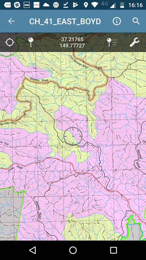
1st off, the supplied NSW DPI maps for hunting are top quality. They show all the roads, creeks, topography and areas you are allowed to hunt.
If you want to use your smart phone, you will need to install Avenza Maps and load the NSW DPI State Forest Hunting maps.
In the above video, ill show you how to download and load the map for Bondi State Forest.
For hunters new to Avenza maps, ill create quick video on how to use it.
I highly recommend that you upgrade to the fully paid version of Avenza maps. The free version limits you to 3 maps. Keep in mind that DPI maps update 4 times a year and you will find yourself having to delete older maps with all your marks on it!
Check out my article on how to use Google Earth and NSW DPI State Forest Hunting Maps
Join my webinar on how to identify productive hunting spots in NSW State Forest and my secret hunting spots
![]()